Research Themes
Water is of primary importance both for the day-to-day operation of Rio Tinto's major aluminum smelting plant in Kitimat, and to ensure the continuing survival of natural ecosystems, and the services they furnish to support human well-being.
The overarching objective of this research program is therefore to improve understanding of how climate change and human intervention in natural drainage systems may combine to impact the long-term water security of the Nechako watershed. This will benefit communities throughout the region, and Rio Tinto's industrial activities.
To this end, the NRT-IRC program's research activities comprise a series of complementary projects, each involving collaborating researchers, stakeholders and graduate students, organized within three main themes:
To read more about each of the projects listed below, click on its title
-
Theme 1: Hydrometeorological Monitoring and Data Collection
-
Project 1.1: Long term hydrometeorological data collection
Hydrometeorological stations from traditional networks have a strong bias towards lower elevations and valley bottoms. Thus, a major initiative of this program of research is to improve the Nechako's monitoring network, especially at higher altitudes, with the expansion of our meteorological network to complement existing infrastructure including Rio Tinto weather stations. A key objective is to record extreme precipitation events during atmospheric rivers (see Project 1.2) that could induce flooding and suddenly raise Nechako Reservoir levels. Another objective is to define how far inland the atmospheric river precipitation shields propagate and help identify the extent and effectiveness of the rain-shadow cast by the Coast Mountains.
-
Project 1.2: Short-term intensive field campaign to monitor atmospheric rivers in fall 2021: the Tahtsa Ranges Atmospheric Rivers Experiment
To obtain more detailed measurements of clouds, precipitation and other atmospheric fields during Pineapple Express storms affecting the headwaters of the Nechako, an intensive field campaign titled the Tahtsa Ranges Atmospheric Rivers Experiment (TRARE) will be launched in autumn of 2021. A mobile observing unit consisting of a storage container with a suite of meteorological instruments will be deployed at a field site near Mt. Sweeney in the Tahtsa Ranges of the Coast Mountains. The mobile unit includes a compact climate sentinel to monitor all standard meteorological variables (air temperature, humidity, pressure, radiation, snow, soil temperature, etc.). It is also equipped with a lidar ceilometer to detect cloud levels aloft. To capture further details on the precipitation fields aloft and near the surface, a micro-rain radar and an optical disdrometer will also be deployed. The 3D wind fields will be measured using a Doppler scanning lidar. Moreover, an extensive array of precipitation gauges deployed for Project 1.1 will capture precipitation gradients and allow quantification of the Coast Mountains' rain-shadow effect during coastal storms.
-
Theme 2: Atmospheric and Terrestrial Rivers
-
Project 2.1: Terrestrial response to atmospheric rivers
An atmospheric river landfall induces a significant hydrological response in the Nechako watershed , with possible notable differences between rivers at high and low elevations of the Coast Mountains. For instance, a rapid (~hours to days) hydrological response may be observed if heavy rainfall (especially onto snow) occurs in low elevation rivers; in contrast, a delayed (~days to months) hydrological response may be seen if heavy snowfall occurs in the mountainous terrain of high-elevation rivers. Flooding could occur in both regions because of a single event but at different times of the year. Waterways draining the Coast Mountains (particularly those in proximity to the Pacific) respond quickly to Pineapple Express storms in autumn given most of the precipitation falls as rain, leading to flash flooding. Higher elevations experience snowfall and thus integrate precipitation over the cold season from multiple events. Flooding in higher elevation basins or those with a more continental climate further inland depend less on a lone atmospheric river event but more so on their cumulative impacts through the cool season and the overall abundance of snowfall. The goal of this project is to identify the most intense atmospheric rivers to affect the Nechako over the past half-century, to characterize the synoptic pattern during each event as well as emerging patterns, and the corresponding precipitation fields in addition to snowpack and hydrological responses to the events.
-
Project 2.2: Flow regulation, climate variability and climate change impacts on observed streamflow in the Nechako watershed
Water retention and releases from the Nechako Reservoir affect downstream reaches of the Nechako and Fraser Rivers. Concurrently, rising air temperatures and precipitation changes affect water availability across the Nechako Reservoir and watershed. Thus the objective of this effort is to quantify the individual roles of flow regulation, climate variability and climate change on observed trends in discharge for the main stem Nechako and Fraser Rivers during the past six decades.
-
Project 2.3: Flow regulation, climate variability and climate change impacts on observed and simulated water temperatures in the Nechako watershed
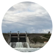
Water management in the Nechako Reservoir not only affects downstream flows but also river water temperatures. Similar to Project 2.2, this effort's main objective is to quantify the individual roles of flow regulation, climate variability and climate change on water temperature trends for the main stem Nechako River during the past six decades. This will include a review of the Summer Temperature Management Project (STMP) that mandates Rio Tinto to release additional water at the Skins Lake Spillway when water temperatures on the main stem Nechako River near Finmoore approach 20°C between 20 July and 20 August each year. A secondary goal is to augment the existing monitoring network of water temperature sensors across the Nechako basin to better capture spatio-temporal variability in water temperatures from headwater streams down to the main stem Nechako River near its confluence with the Fraser River for improved model simulations.
-
Theme 3: Hydrological and Water Temperature Modeling
-
Project 3.1: Simulating the historical hydrology of the Nechako watershed
In a context of past climate change, knowledge on the drivers of historical trends in water resources in the Nechako watershed is of utmost importance. The objective of this effort is thus to generate reliable simulations of hydrological processes and water resources in the vast, complex terrain of the Nechako watershed via improved numerical models applied at high spatio-temporal resolutions to allow proper depictions of glaciers, lakes, reservoirs, and landcover types.
-
Project 3.2: Projecting the future hydrology of the Nechako watershed
GCM-based projections of future climate in north-central BC suggest air temperatures will rise an additional 3-5°C by 2100 with modest increases in total annual precipitation marked by robust increases in rainfall and declines in snowfall. Thus, by the end of the 21st century, climate change may exceed the impacts of flow regulation through releases at the Skins Lake Spillway and the interbasin diversion of flows towards the Kemano Powerhouse (if maintained at their current levels) on streamflow timing and amounts on the Nechako River's main stem. The goal of this effort is to develop projections of the potential future state and fate of water security in the Nechako watershed by assessing impacts of warmer conditions and changing precipitation patterns on its water resources.
-
Project 3.3: Projecting future water temperatures in the Nechako watershed
It is possible that rises in air temperatures and decreases in flows driven by climate change may exceed the influences of flow regulation alone on water temperatures in the Nechako River by 2100. This project aims to assess how projected future climate change may impact the thermal regimes of the Nechako River and its unregulated tributaries.


