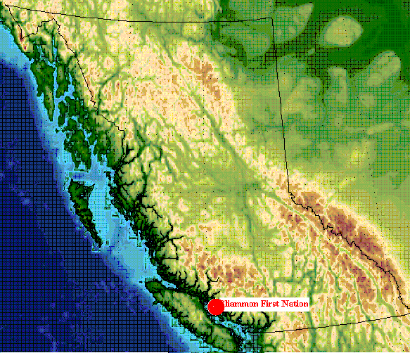
Sliammon First Nation:

    Co-Management of the Theodosia River


History Of Sliammon

HOME

The Sliammon people have lived along shores of the Northern Strait of Georgia in British Columbia, for thousands of years.

 The Sliammon people acquired large knowledge of the extensive British Columbia coastline, and knew their territory intimately. The Sliammon did ventured outside of their traditional territory, this was expected because, they visited other neighboring communities and to trade for certain things they did not have access to within their own territory (Kennedy, 1983).

In the northern stretches of the Strait of Georgia there is a maze of inlets, bays, river estuaries and sheltered coves along which the ancestors of the Sliammon made their homes. Sliammon people would build their villages close to the natural resources in order to utilize them in the most productive way possible. Some of the primary settlements were located at Theodosia River estuary, Desolation Sound, Coast of the Malaspina Strait, Powell River, and many islands within the Strait of Georgia including Harwood and Savary Island. Many of these locations along the coast have become protected archaeological sites. Although after the construction of the Powell River dam in 1912  to make way for hydroelectric development and the construction of the Powell River Co. Pulp and Paper Mill one of the main old village sites  called Tiskw'at was flooded destroying a lot of prehistoric evidence of land and resource use by the Sliammon people (Sliammon first Nations web).

The Sliammon Indian  Reserve located 12 km north of  the town site of Powell River has been the main village of the Sliammon now and in the past.

The existence of the Sliammon can be dated back to about 2000 years ago, though some archaeology sites have been found that are in the range of about 8000 years old. This gives substantial proof of land occupancy to the Sliammon in there fight for land claims (Powell River Timeline web).


Location Of Sliammon First Nation in British Columbia

Time Line

1763 - Royal Proclamation recognizes people as 'nations or tribes' and acknowledges that they continue to possess traditional territories until they are 'ceded to or purchased' by the Dominion.

 1774- First recorded contact between aboriginal and non-aboriginal people in B.C.

1850-1854 - Douglas Treaties: Under instruction from British Crown, Douglas signs 14 treaties on Vancouver Island. Process discontinued due to lack of funds from England and various other factors.

1862 - Smallpox epidemic kills approximately one of every three aboriginal people in the province.

 1870's - First recorded contact with the Oblate Missionaries. Services were held at both the mouth of Powell Lake and at Grace Harbour.

1871 - British Colombia enters Confederation and the federal government given responsibility for Indians.

1873 - the Federal government forms the Northwest Mounted Police to attend to conflicts between the Natives and the white settlers.

1876- Federal Indian Act sets up a system of Indian bands and reserves and establishes wide range of controls over aboriginal population. Allows only those people registered under the Indian Act to live on reserves. Provides that reserves can only be reduced in size with the consent of all adult males in the band and encourages aboriginal people to voluntarily give up special status as registered Indians.

1879 - The six reserves of Sliammon are issued by the provincial government.


(Sliammon Treaty Society web, Ministry of Aboriginal Affairs web)

HISTORY

THEODOSIA
RIVER

TREATY

CO-MANAGEMENT

BIBLIOGRAPHY

LINKS

next

Created by Andy Bessant for Geog 403 at the University of Northern British Columbia. 02/03/28


 Copyright or other proprietary statement goes here.
For problems or questions regarding this web contact [ProjectEmail].
Last updated: 03/28/02.